Site: Blacks Fork
County, State: Summit, Utah
Years of Occupation: 1870-1930
Status of Site: Private Property, not currently signed against visiting
Classification: Class 2 - Neglected Town
Type: Logging
Remnants: 12+ cabin/building remnants. All are in various states of decay.
GPS Coordinate: 40.971° N, 110.587° W
 (Medium).JPG")
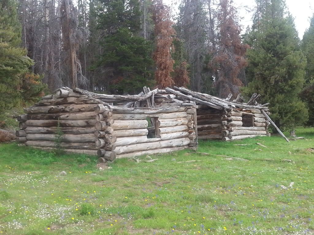
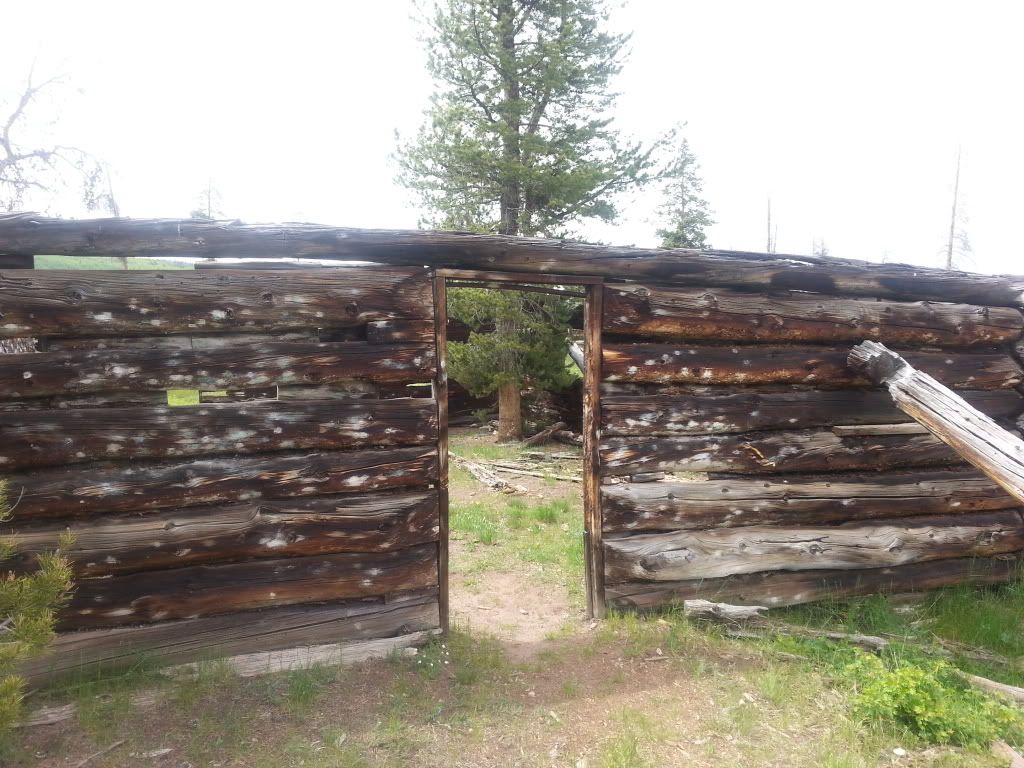
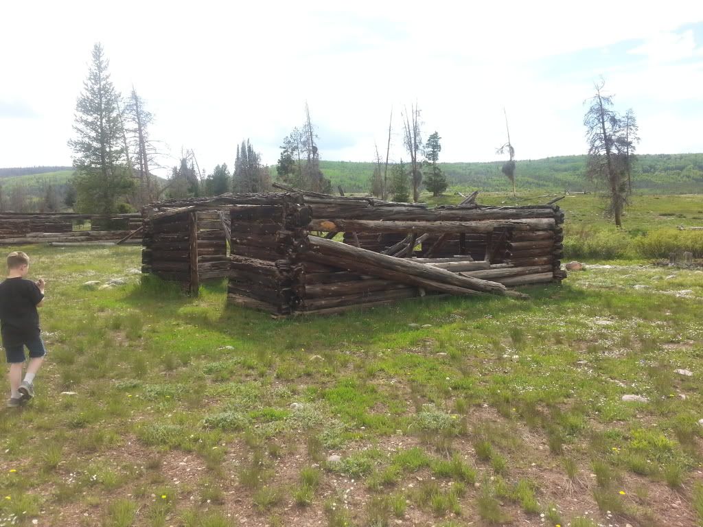
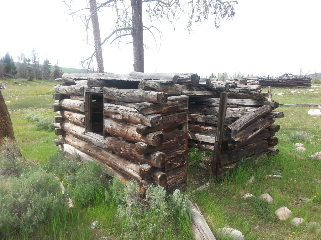
Large single room cabin near towns center
Blacks Fork was first settled during the 1870's, serving as a supply and housing outpost for timber companies operating along the northern slope of the Uinta Mountains. Funding for the construction and influx of workers was likely provided by the timber contractor, thus making it a company town rather than a general community. Timber was in high demand for railroad ties, mining timbers, building purposes and charcoal production throughout the west. The Transcontinental Railroad had recently been completed north of Blacks Fork connecting the east with the west, spur rails were being built to the north and south, connecting communities across the nation. With mining booming throughout the Rocky Mountains, timber was needed within the mine and their large shipments along with general freight needs were pushing exponential railroad construction throughout the region. In nearby Piedmont, Wyoming (~30 miles to the north) 5 large capacity charcoal kilns were constructed, thus providing another major demand for timber products in the area. At some point a log flume was constructed to the west of the town site to move the timber to the railroad, no evidence of this flume has been found to date. Previous to the flume, logs were moved in the winter months as the the icy ground made the heavy logs easy to drag. At the height of its activity the population was rumored to be 50-100 men, no viable sources have been found to date. The site was abandoned in the 1930's when the timber company went out of business, the town was never permanently re-occupied.
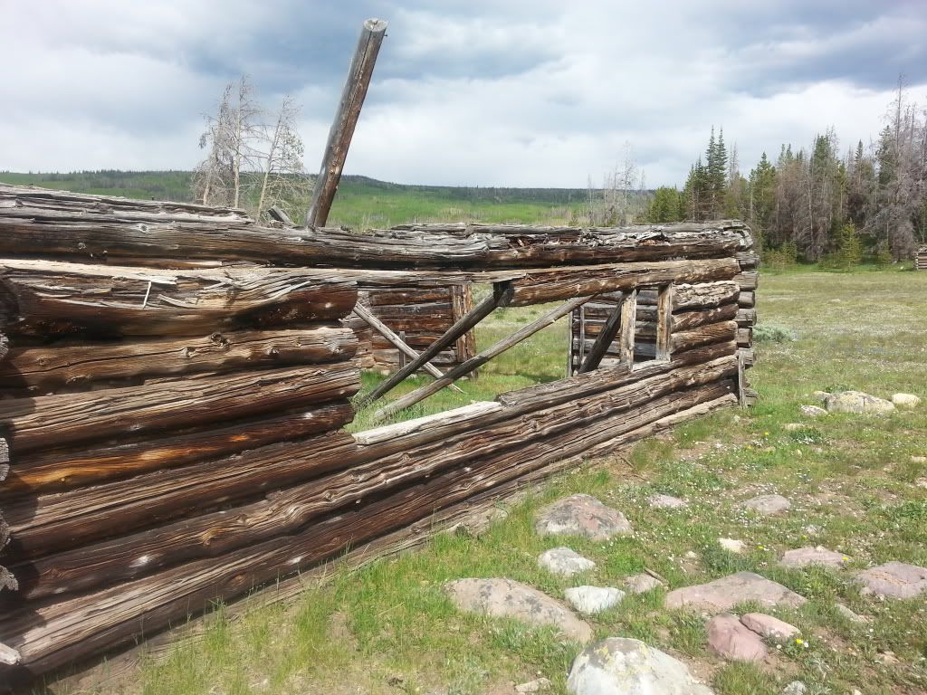
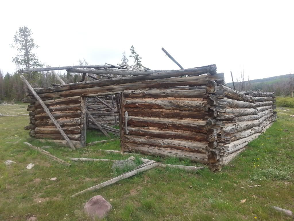
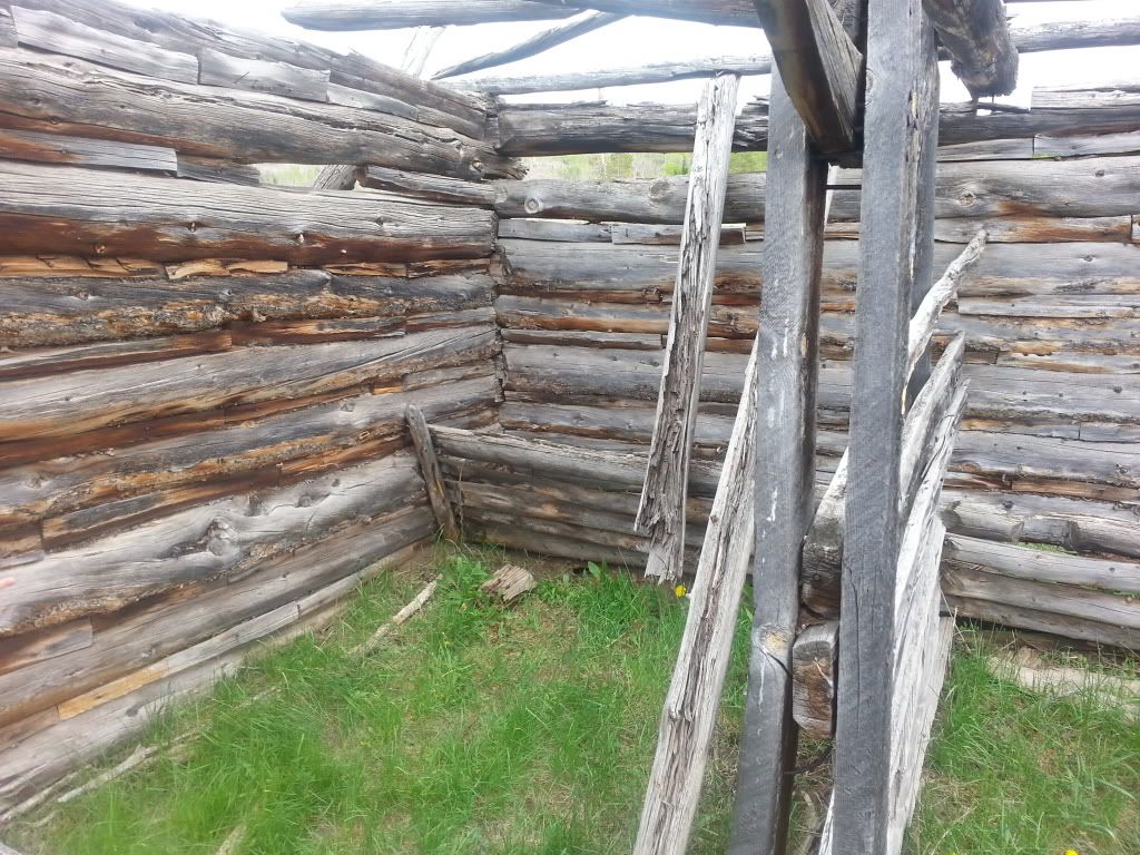
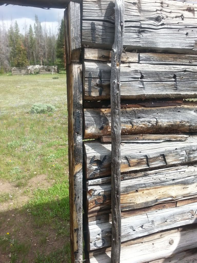
The Blacks Fork site consists of over a dozen log cabins in various states of decay. Some are little more than a pile of broken and rotted logs, others have solid standing walls though caved roofs. Ideally this site needs some sort of restoration and or stabilization efforts in order to preserve it for future generations. Nearby forest fires and vandalism have threatened the remaining structures but fortunately it is still in relatively remarkable condition given the age. The exact town layout is unknown but the remaining buildings and foundations suggest the majority of the peripheral cabin sites served as housing, perhaps boarding houses for many single men due to their duplex style design. The central buildings likely served as stables and liveries, mess halls, company offices, and various sources state there was a post office operating in the town, we have been unable to confirm any official post office or which building would been utilized. As teamsters hauled regular timber shipments were outbound to nearby Fort Bridger and Piedmont, Wyoming, it was likely the mail was sent along with those freighters and returned with the empty timber wagons.
 (Medium).JPG")
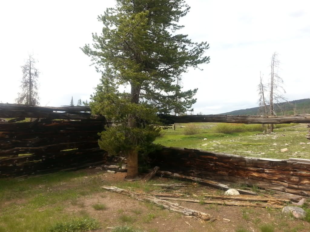
Multiple duplex cabins on western edge of townsite
Additional Reading:
http://www.ghosttowns.com/states/ut/black%27sfork.html
http://en.wikipedia.org/wiki/Blacks_Fork,_Utah
To Get There: Google Maps Link
From Kamas, Utah - Take the Mirror Lake High Way (SR150) 47 miles, turn right (east) onto Mill Creek Road (FR058). Mill Creek will continue (dirt road) for 18 miles at which point you will hit a major intersection, continue north for another 1.5 miles (still on FR058) and the Blacks Fork town site will be easily visible on the west side of the road in a large meadow.
From Interstate 80 in Wyoming: Exit I80 at Exit 34 (Fort Bridger). Continue south onto I80 Bus Loop, head east for 5.5 miles until you hit WY414, turn right and continue south for 3.1 miles. Turn right onto WY410 and continue for 13.3 miles. Turn left (south) on CR271, continue on dirt road passing Meeks Cabin Reservoir and into Utah for 15.3 miles. From Utah/Wyoming border, continue south on FR058 for 2 miles, Black Fork town site will be easily visible on the west side of the road in a large meadow. Park along the road and walk into the town site.
Additional Pictures:
 (Medium).JPG")
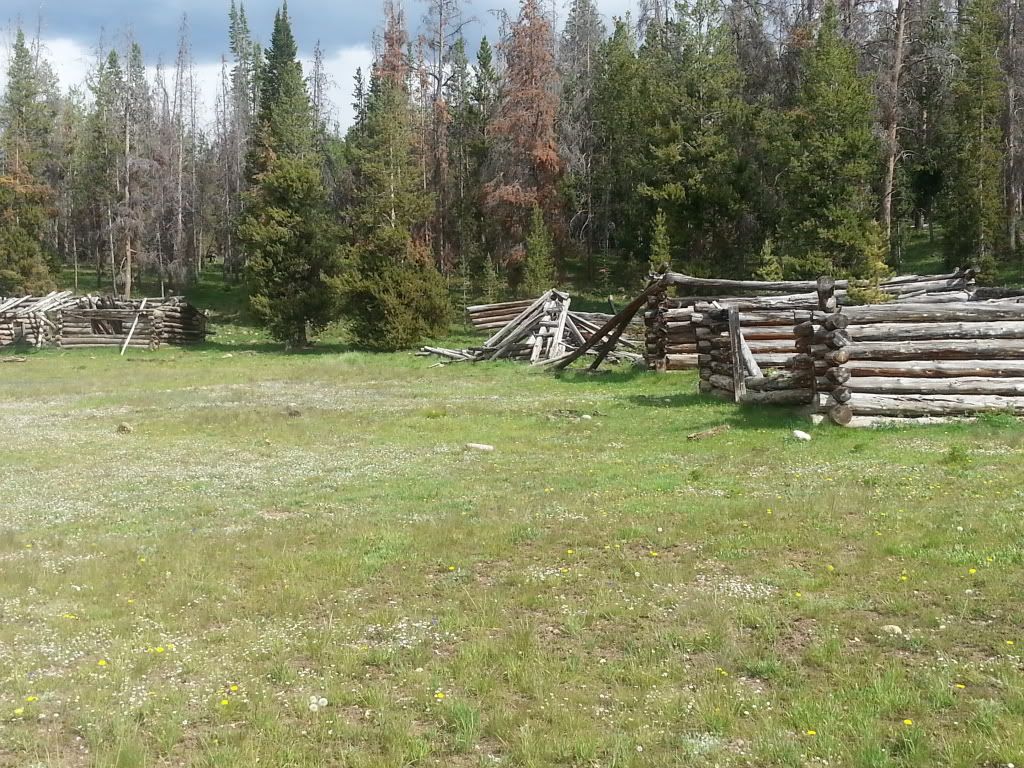
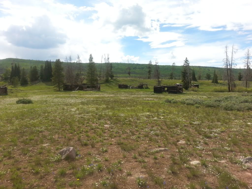
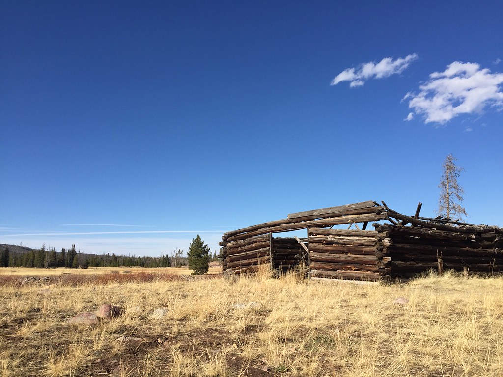
Blacks Fork as viewed from road
 (Medium).JPG")
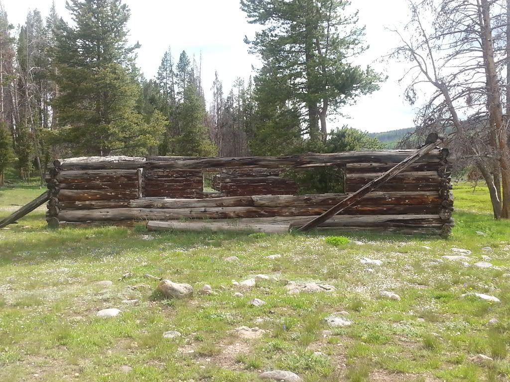
Duplex style cabin at south end of townsite
 (Medium).JPG")
Fallen structures
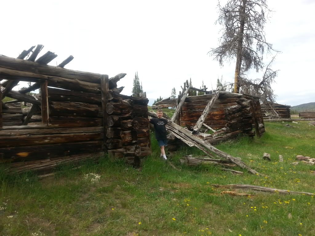
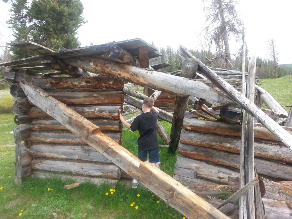
 (Medium).JPG")
Posing at one of the sites cabins
Feel free to post up any stories or pictures you might have of Blacks Fork
County, State: Summit, Utah
Years of Occupation: 1870-1930
Status of Site: Private Property, not currently signed against visiting
Classification: Class 2 - Neglected Town
Type: Logging
Remnants: 12+ cabin/building remnants. All are in various states of decay.
GPS Coordinate: 40.971° N, 110.587° W
Large single room cabin near towns center
Blacks Fork was first settled during the 1870's, serving as a supply and housing outpost for timber companies operating along the northern slope of the Uinta Mountains. Funding for the construction and influx of workers was likely provided by the timber contractor, thus making it a company town rather than a general community. Timber was in high demand for railroad ties, mining timbers, building purposes and charcoal production throughout the west. The Transcontinental Railroad had recently been completed north of Blacks Fork connecting the east with the west, spur rails were being built to the north and south, connecting communities across the nation. With mining booming throughout the Rocky Mountains, timber was needed within the mine and their large shipments along with general freight needs were pushing exponential railroad construction throughout the region. In nearby Piedmont, Wyoming (~30 miles to the north) 5 large capacity charcoal kilns were constructed, thus providing another major demand for timber products in the area. At some point a log flume was constructed to the west of the town site to move the timber to the railroad, no evidence of this flume has been found to date. Previous to the flume, logs were moved in the winter months as the the icy ground made the heavy logs easy to drag. At the height of its activity the population was rumored to be 50-100 men, no viable sources have been found to date. The site was abandoned in the 1930's when the timber company went out of business, the town was never permanently re-occupied.
The Blacks Fork site consists of over a dozen log cabins in various states of decay. Some are little more than a pile of broken and rotted logs, others have solid standing walls though caved roofs. Ideally this site needs some sort of restoration and or stabilization efforts in order to preserve it for future generations. Nearby forest fires and vandalism have threatened the remaining structures but fortunately it is still in relatively remarkable condition given the age. The exact town layout is unknown but the remaining buildings and foundations suggest the majority of the peripheral cabin sites served as housing, perhaps boarding houses for many single men due to their duplex style design. The central buildings likely served as stables and liveries, mess halls, company offices, and various sources state there was a post office operating in the town, we have been unable to confirm any official post office or which building would been utilized. As teamsters hauled regular timber shipments were outbound to nearby Fort Bridger and Piedmont, Wyoming, it was likely the mail was sent along with those freighters and returned with the empty timber wagons.
Multiple duplex cabins on western edge of townsite
Additional Reading:
http://www.ghosttowns.com/states/ut/black%27sfork.html
http://en.wikipedia.org/wiki/Blacks_Fork,_Utah
To Get There: Google Maps Link
From Kamas, Utah - Take the Mirror Lake High Way (SR150) 47 miles, turn right (east) onto Mill Creek Road (FR058). Mill Creek will continue (dirt road) for 18 miles at which point you will hit a major intersection, continue north for another 1.5 miles (still on FR058) and the Blacks Fork town site will be easily visible on the west side of the road in a large meadow.
From Interstate 80 in Wyoming: Exit I80 at Exit 34 (Fort Bridger). Continue south onto I80 Bus Loop, head east for 5.5 miles until you hit WY414, turn right and continue south for 3.1 miles. Turn right onto WY410 and continue for 13.3 miles. Turn left (south) on CR271, continue on dirt road passing Meeks Cabin Reservoir and into Utah for 15.3 miles. From Utah/Wyoming border, continue south on FR058 for 2 miles, Black Fork town site will be easily visible on the west side of the road in a large meadow. Park along the road and walk into the town site.
Additional Pictures:
Blacks Fork as viewed from road
Duplex style cabin at south end of townsite
Fallen structures
Posing at one of the sites cabins
Feel free to post up any stories or pictures you might have of Blacks Fork
Last edited: