Site: Joy
Alternate Names: N/A
County, State: Juab, UT
Years of Occupation: 1872-?
Status of Site: Open
Classification: Class 1
Type: Mining
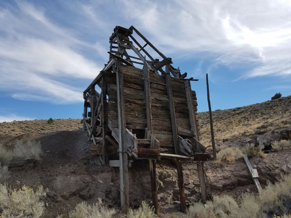
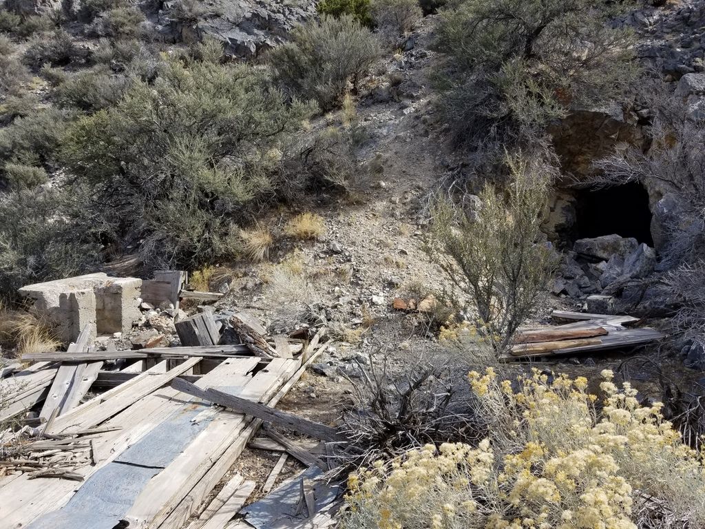
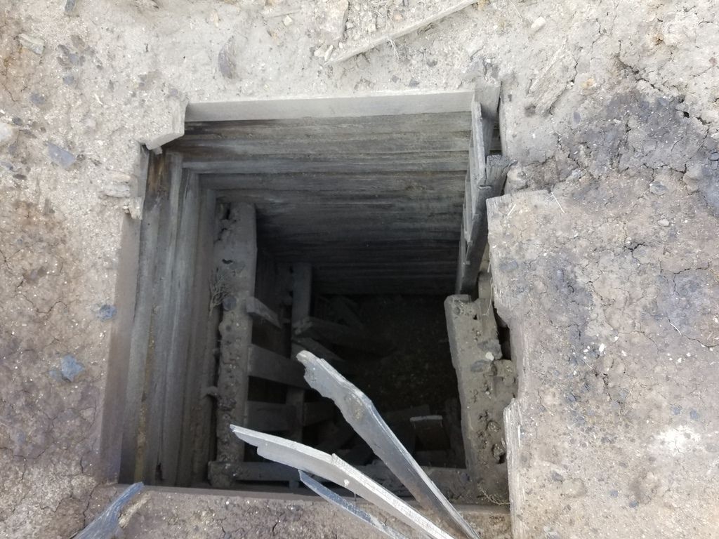
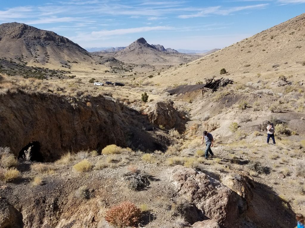
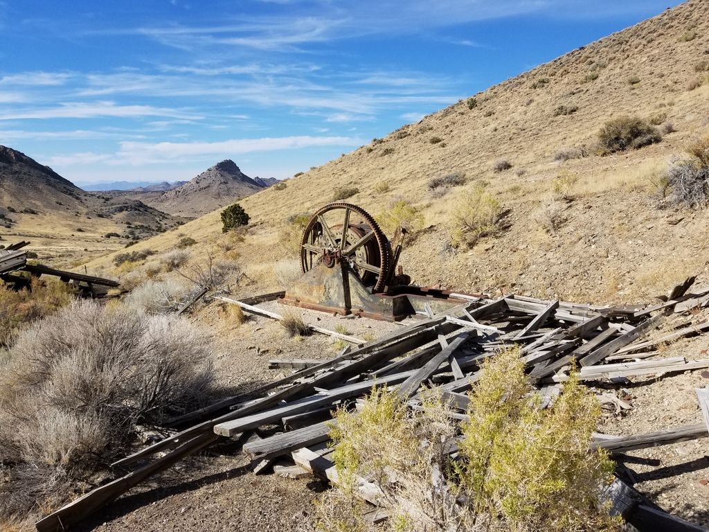
Remnants: Empty site. Some mining relics in the hills near by.
GPS Coordinate: 39.572097, -113.061445
NRHP Reference#:
Date of Last Visit: 10/23/2016
Site history: Joy was settled in 1872 as the center of the Detroit mining district by Harry Joy (one of the founders of the Packard Motor Company) and Charles Howard.
Site status and condition: Abandoned. No remains of the town are readily visible at the site of Joy itself. Two grave markers by the side of the road appear to be relatively modern additions. The foothills to the southeast contain the remains of mining operations, most notably the Black Boy complex. Multiple open and unmarked shafts and adits dictate caution.
Further Reading:
http://www.onlineutah.com/joyhistory.shtml
Directions to Get There:
Access to the town of Joy is easy from several directions, on graded gravel roads. Approximately 10 miles north of Delta on US6, turn west onto the Brush Hwy. Travel approximately 31 miles, watch for an unmarked four way intersection with an unnamed dirt road. Turn left (SW) onto the dirt road and follow it 7 miles to the site of Joy.
Vehicle access to the mines to the southeast is on unmaintained roads, and may require high clearance and/or 4WD depending on local conditions.
Frequently Asked Questions (FAQ):
Alternate Names: N/A
County, State: Juab, UT
Years of Occupation: 1872-?
Status of Site: Open
Classification: Class 1
Type: Mining
Remnants: Empty site. Some mining relics in the hills near by.
GPS Coordinate: 39.572097, -113.061445
NRHP Reference#:
Date of Last Visit: 10/23/2016
Site history: Joy was settled in 1872 as the center of the Detroit mining district by Harry Joy (one of the founders of the Packard Motor Company) and Charles Howard.
Site status and condition: Abandoned. No remains of the town are readily visible at the site of Joy itself. Two grave markers by the side of the road appear to be relatively modern additions. The foothills to the southeast contain the remains of mining operations, most notably the Black Boy complex. Multiple open and unmarked shafts and adits dictate caution.
Further Reading:
http://www.onlineutah.com/joyhistory.shtml
Directions to Get There:
Access to the town of Joy is easy from several directions, on graded gravel roads. Approximately 10 miles north of Delta on US6, turn west onto the Brush Hwy. Travel approximately 31 miles, watch for an unmarked four way intersection with an unnamed dirt road. Turn left (SW) onto the dirt road and follow it 7 miles to the site of Joy.
Vehicle access to the mines to the southeast is on unmaintained roads, and may require high clearance and/or 4WD depending on local conditions.
Frequently Asked Questions (FAQ):