Site: Goshute Canyon
Alternate Names: Oro Del Rey Mine, Eagles Nest, Devils Pit
County, State: Tooele, Utah
Years of Occupation: 1933 to 1954
Status of Site: Open
Classification: Class 2 - Neglected Town
Type: Mining
Remnants: Multiple cabins, mines structures and headframes
GPS Coordinate: 39.923366, -113.838074
NRHP Reference#: If applicable
Date of Last Visit:
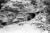
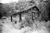
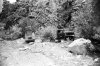
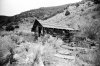
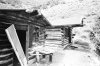
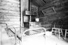
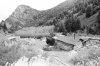
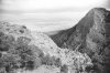
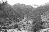
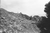
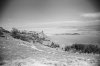
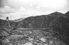
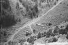
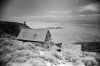
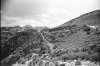
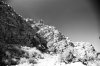
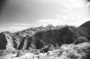
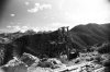
Goshute Canyon is located in the Deep Creek mountains in Utah's remote, western deserts. The canyon is located 6 miles west of Callao and includes the Eagles Nest mine, the Oro del Rey workings, the Evelyn mine, and the Silver Queen property. Goshute canyon was booming with mining activity in the 1870's and 1880's when the population of Cherry Creek grew to about 6,000 residents. Some mining took place in 1982 when the Kibbe company of Salt Lake City started to work the Evelyn mine. A crusher and heap leach pads were placed at the mouth of Goshute Canyon and around 2,000 ft of underground workings were developed along a gold-bearing quartz vein, and sloping was done along the vein for about 160 ft. An undisclosed amount of gold was produced in 1983, which most likely means a lot of gold if they refused to say, and were processing their own gold. The other mines in the area produced an approximate combined total of about 20,000 oz between 1934 and 1954. The Oro del Rey workings are about 1 mile south of the Eagles Nest mine. In 1990 46 samples were taken along a quartz vein that is present in and between the workings. All samples from the vein contained gold. The vein is exposed in the workings for 1,380 ft between the many workings. In 1990 the mines had an in-place value of $100 million, using a gold price of $450/oz. That was back when the area was just a Wilderness study area. Site research courtesy of Gold Rush Expeditions. Historic pictures are from 1977, courtesy of Gold Rush Expeditions & Ed Gosling
Further Reading:
http://www.expeditionutah.com/forum/showthread.php?t=213
http://www.expeditionutah.com/forum/showthread.php?t=3438
http://www.expeditionutah.com/forum/showthread.php?t=4139
http://thetrekplanner.com/oro-del-rey-mine-goshute-canyon-deep-creek-mountains/
http://desertratadventure.blogspot.com/2011/06/adventure-to-oro-del-ray-mine.html
http://content.lib.utah.edu/utils/getfile/collection/etd3/id/1701/filename/1709.pdf
http://content.lib.utah.edu/utils/getfile/collection/etd3/id/1705/filename/1710.pdf
http://digitallibrary.utah.gov/awweb/awarchive?type=file&item=31759
Directions to Get There:
Access is by means of a rough road that leads 6-8 miles west from Callao into the Silver Queen and Lower Goshute Canyon workings. Continuing up Goshute Canyon to Devils Pit-Oro del Rey-Eagles Nest area , the road becomes steep and difficult to traverse. The Prosperity claim is accessible only on foot or horseback from the Oro del Rey area. (11/27/16 Update: The road is impassible to full-size 4x4 access by boulders and a downed tree, groups are discussing timing to go clear the route)
Modern Pictures:

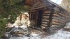
(Photo Courtesy of Ed Horton)
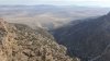
(Photo Courtesy of Ed Horton)
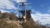
(Photo Courtesy of Ed Horton)
(Photo Courtesy of Ed Horton)
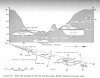
Mine Workings Cross-Section:
Alternate Names: Oro Del Rey Mine, Eagles Nest, Devils Pit
County, State: Tooele, Utah
Years of Occupation: 1933 to 1954
Status of Site: Open
Classification: Class 2 - Neglected Town
Type: Mining
Remnants: Multiple cabins, mines structures and headframes
GPS Coordinate: 39.923366, -113.838074
NRHP Reference#: If applicable
Date of Last Visit:
Goshute Canyon is located in the Deep Creek mountains in Utah's remote, western deserts. The canyon is located 6 miles west of Callao and includes the Eagles Nest mine, the Oro del Rey workings, the Evelyn mine, and the Silver Queen property. Goshute canyon was booming with mining activity in the 1870's and 1880's when the population of Cherry Creek grew to about 6,000 residents. Some mining took place in 1982 when the Kibbe company of Salt Lake City started to work the Evelyn mine. A crusher and heap leach pads were placed at the mouth of Goshute Canyon and around 2,000 ft of underground workings were developed along a gold-bearing quartz vein, and sloping was done along the vein for about 160 ft. An undisclosed amount of gold was produced in 1983, which most likely means a lot of gold if they refused to say, and were processing their own gold. The other mines in the area produced an approximate combined total of about 20,000 oz between 1934 and 1954. The Oro del Rey workings are about 1 mile south of the Eagles Nest mine. In 1990 46 samples were taken along a quartz vein that is present in and between the workings. All samples from the vein contained gold. The vein is exposed in the workings for 1,380 ft between the many workings. In 1990 the mines had an in-place value of $100 million, using a gold price of $450/oz. That was back when the area was just a Wilderness study area. Site research courtesy of Gold Rush Expeditions. Historic pictures are from 1977, courtesy of Gold Rush Expeditions & Ed Gosling
Further Reading:
http://www.expeditionutah.com/forum/showthread.php?t=213
http://www.expeditionutah.com/forum/showthread.php?t=3438
http://www.expeditionutah.com/forum/showthread.php?t=4139
http://thetrekplanner.com/oro-del-rey-mine-goshute-canyon-deep-creek-mountains/
http://desertratadventure.blogspot.com/2011/06/adventure-to-oro-del-ray-mine.html
http://content.lib.utah.edu/utils/getfile/collection/etd3/id/1701/filename/1709.pdf
http://content.lib.utah.edu/utils/getfile/collection/etd3/id/1705/filename/1710.pdf
http://digitallibrary.utah.gov/awweb/awarchive?type=file&item=31759
Directions to Get There:
Access is by means of a rough road that leads 6-8 miles west from Callao into the Silver Queen and Lower Goshute Canyon workings. Continuing up Goshute Canyon to Devils Pit-Oro del Rey-Eagles Nest area , the road becomes steep and difficult to traverse. The Prosperity claim is accessible only on foot or horseback from the Oro del Rey area. (11/27/16 Update: The road is impassible to full-size 4x4 access by boulders and a downed tree, groups are discussing timing to go clear the route)
Modern Pictures:
(Photo Courtesy of Ed Horton)
(Photo Courtesy of Ed Horton)
(Photo Courtesy of Ed Horton)
(Photo Courtesy of Ed Horton)
Mine Workings Cross-Section: